


Florence & Darlington Counties--Florence City PUMA, South Carolina
About
Outline

Summary
| Unique Area Identifier | 193959 |
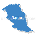
| Name | Florence & Darlington Counties--Florence City PUMA |
| State | South Carolina |
| Area (square miles) | 1,370.53 |
| Land Area (square miles) | 1,361.12 |
| Water Area (square miles) | 9.41 |
| % of Land Area | 99.31 |
| % of Water Area | 0.69 |
| Latitude of the Internal Point | 34.15377450 |
| Longtitude of the Internal Point | -79.80607930 |
Maps


Graphs
Select a template below for downloading or customizing gragh for Florence & Darlington Counties--Florence City PUMA, South Carolina


Neighbors
Neighoring Public Use Microdata Area (by Name) Neighboring Public Use Microdata Area on the Map
- Georgetown, Marion & Dillon Counties PUMA, SC
- Kershaw, Richland (South) & Calhoun Counties PUMA, SC
- Lancaster, Chesterfield & Marlboro Counties PUMA, SC
- Sumter, Clarendon, Williamsburg & Lee Counties--Sumter City PUMA, SC
Top 10 Neighboring County (by Population) Neighboring County on the Map
- Florence County, SC (136,885)
- Sumter County, SC (107,456)
- Darlington County, SC (68,681)
- Kershaw County, SC (61,697)
- Chesterfield County, SC (46,734)
- Clarendon County, SC (34,971)
- Williamsburg County, SC (34,423)
- Marion County, SC (33,062)
- Dillon County, SC (32,062)
- Marlboro County, SC (28,933)
Top 10 Neighboring County Subdivision (by Population) Neighboring County Subdivision on the Map
- Florence CCD, Florence County, SC (70,050)
- Darlington CCD, Darlington County, SC (26,541)
- Hartsville CCD, Darlington County, SC (19,077)
- Pamplico CCD, Florence County, SC (17,645)
- Marion CCD, Marion County, SC (17,180)
- Bennettsville CCD, Marlboro County, SC (16,365)
- Danwood CCD, Florence County, SC (15,155)
- Cheraw CCD, Chesterfield County, SC (14,516)
- Lake City-Scranton CCD, Florence County, SC (12,921)
- North Hartsville CCD, Darlington County, SC (11,378)
Top 10 Neighboring Place (by Population) Neighboring Place on the Map
- Florence city, SC (37,056)
- Hartsville city, SC (7,764)
- Lake City city, SC (6,675)
- Darlington city, SC (6,289)
- North Hartsville CDP, SC (3,251)
- Timmonsville town, SC (2,320)
- Johnsonville city, SC (1,480)
- Pamplico town, SC (1,226)
- Lamar town, SC (989)
- Scranton town, SC (932)
Top 10 Neighboring Unified School District (by Population) Neighboring Unified School District on the Map
- Florence School District 1, SC (96,463)
- Darlington County School District, SC (68,681)
- Kershaw County School District, SC (61,697)
- Sumter School District 2, SC (57,252)
- Chesterfield County School District, SC (46,734)
- Williamsburg County School District, SC (34,423)
- Marlboro County School District, SC (28,933)
- Florence School District 3, SC (20,584)
- Lee County School District, SC (19,220)
- Marion School District 1, SC (15,337)
Top 10 Neighboring State Legislative District Lower Chamber (by Population) Neighboring State Legislative District Lower Chamber on the Map
- State House District 63, SC (38,360)
- State House District 60, SC (34,706)
- State House District 64, SC (34,361)
- State House District 55, SC (34,048)
- State House District 65, SC (33,735)
- State House District 61, SC (33,723)
- State House District 62, SC (33,398)
- State House District 50, SC (33,358)
- State House District 59, SC (32,551)
- State House District 54, SC (32,159)
Top 10 Neighboring State Legislative District Upper Chamber (by Population) Neighboring State Legislative District Upper Chamber on the Map
- State Senate District 31, SC (97,972)
- State Senate District 27, SC (91,873)
- State Senate District 30, SC (89,291)
- State Senate District 35, SC (87,583)
- State Senate District 36, SC (84,337)
- State Senate District 29, SC (82,439)
- State Senate District 32, SC (81,778)
Top 10 Neighboring 111th Congressional District (by Population) Neighboring 111th Congressional District on the Map
Top 10 Neighboring Census Tract (by Population) Neighboring Census Tract on the Map
- Census Tract 14, Florence County, SC (7,856)
- Census Tract 2.02, Florence County, SC (7,785)
- Census Tract 9706, Dillon County, SC (7,496)
- Census Tract 109, Darlington County, SC (7,095)
- Census Tract 19, Florence County, SC (6,556)
- Census Tract 9602, Marlboro County, SC (6,264)
- Census Tract 9506, Chesterfield County, SC (6,113)
- Census Tract 16.01, Florence County, SC (6,084)
- Census Tract 5, Florence County, SC (6,018)
- Census Tract 15.04, Florence County, SC (5,939)
Top 10 Neighboring 5-Digit ZIP Code Tabulation Area (by Population) Neighboring 5-Digit ZIP Code Tabulation Area on the Map
- 29501, SC (43,220)
- 29550, SC (32,284)
- 29505, SC (24,279)
- 29506, SC (20,960)
- 29532, SC (20,871)
- 29512, SC (19,514)
- 29571, SC (15,622)
- 29520, SC (14,617)
- 29560, SC (13,664)
- 29010, SC (13,491)